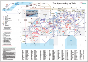
The Alps-Skiing by Train (download)
£2.50 Ex VAT (£3.00 Inc VAT)
Description
Description
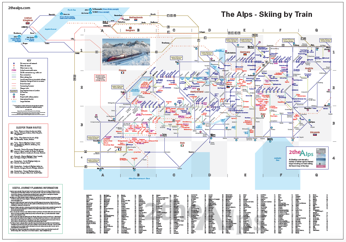
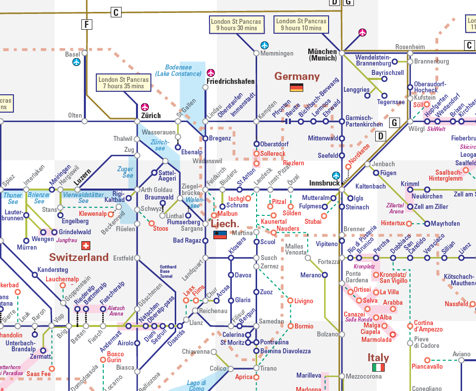
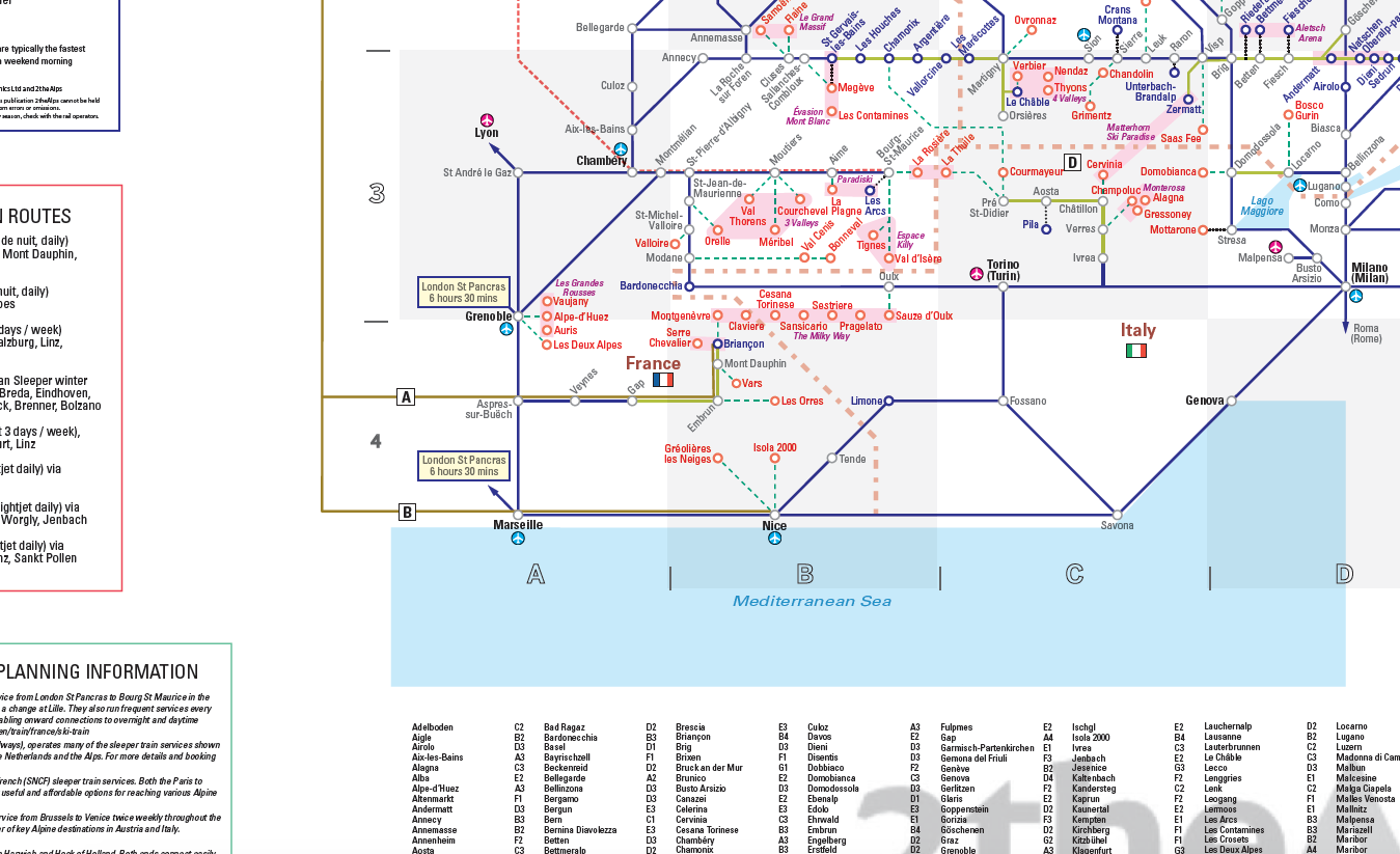
Download this great map by our partners at 2theAlps. A new design and fully updated version of the existing map, this is a perfect guide to help you plan your trip to and navigate your way around the Alps by Train.
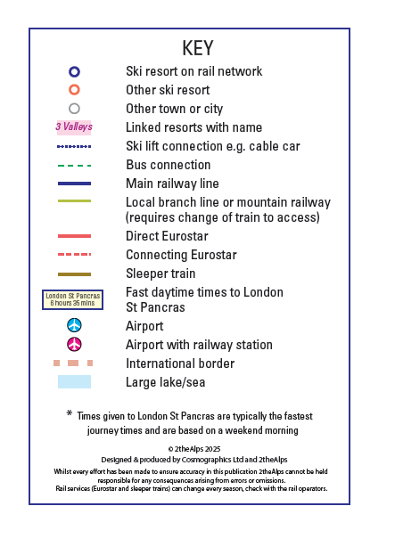
The map includes rail links to the Alps from the UK and surrounding countries and also includes ferries. The rail network is shown in detail in the Alps, with main and local branch lines and ski lift and bus connections to resorts. The map clearly identifies ski resorts on the rail network. Routes to the Alps include the sleeper train routes, these are also listed outside of the map along with other useful information.
The download is designed for use on your computer and is not setup for quality printing. Printed versions of the map are also available. Not for resale or commercial use. Please contact us should you wish to use in a publication, on a website or licence to print, we would be pleased to help. For more information about 2theAlps other winter sports maps checkout their website www.2thealps.com.
Purchase using Paypal (card) and the map will be available to download. If you pay by BACs we will forward the map by email once you have placed the order and paid.
Reviews (0)
Related products
-

Colour blind friendly Political World Map (large)
£17.99 – £125.50 Select options This product has multiple variants. The options may be chosen on the product page -
Adventures by Train in the Alps map gift (UK free delivery)
£19.99 Select options This product has multiple variants. The options may be chosen on the product page -
Adventures in the Alps map gift (UK free delivery)
£19.99 Select options This product has multiple variants. The options may be chosen on the product page -
The Alps- Skiing by Train map
£17.00 – £48.00 Select options This product has multiple variants. The options may be chosen on the product page
Reviews
There are no reviews yet.